Ordnance Survey
Yorkshire 3 Peaks Map, Yorkshire Dales Map, OS Explorer OL2 Yorkshire Three Peaks Challenge Map
Yorkshire 3 Peaks Map, Yorkshire Dales Map, OS Explorer OL2 Yorkshire Three Peaks Challenge Map
Couldn't load pickup availability
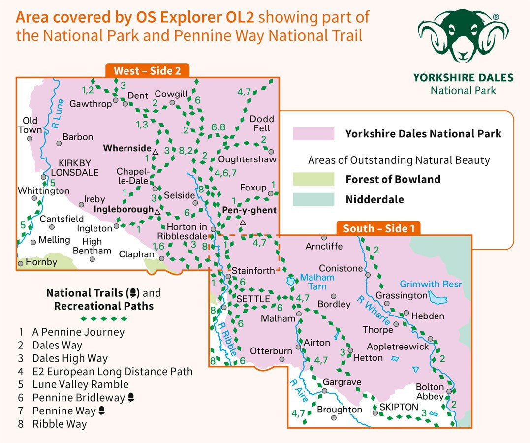
Ordnance Survey's OL2 Explorer map, covering the complete Yorkshire Three Peaks Challenge route, Whernside, Ingleborough and Pen-y-ghent, all on the West sheet of the map.
The Active version of this map is the waterproof version of the Yorkshire Three Peaks map. It's slightly bulkier than the standard map and weighs 200 grams, compared to the standard 130g.
The Active version is our preferred version for the challenge - to make it more practical to use we suggest peeling off the cardboard cover and cutting the map sheet down close to the size of the route.
This is the latest revision of the map, last revised in August 2016. Inside the map is a code to download a digital companion map.
Also includes parts of the Pennine Way, Ribble Way, and the Dales Way, and the villages of Settle, Skipton, Malham, Clapham, Kirkby Longsdale, Ingleton and Horton-in-Ribblesdale.
Share